COLD RIVER LOCAL ADVISORY COMMITTEE

The path of the cold river

  • Home
  • About
    • History of the Committee
    • Annual Reports
    • Bylaws
    • Events Calendar
  • Learn about Cold River
    • Path of the River
    • Wildlife >
      • Habitats
      • Animals >
        • Mammals
        • Fish
        • Birds
        • Invertebrates
        • Endangered Species
      • Plants >
        • Endangered Species
        • Habitats
    • Geology >
      • Bedrock Geology
      • Surficial Geology
      • Sand and Gravel Deposits
      • Prime Agricultural Soils
      • Groundwater Resources
    • Watershed
    • Cold River History >
      • Historical Landmarks
      • Local Oral Histories
  • Water Quality Monitoring
    • What we do
    • Drinking Water Protection Plan
    • Get Involved
  • Conservation
    • Restoration Projects
    • Towns >
      • Town Conservation Commitments
      • Town land use Controls
      • Town Links
  • Educator Resources
    • Activities
    • Artwork
    • River Links
  • Contact Us
Picture
The Cold River begins in the hills of northwest Acworth and Unity at Crescent Lake (1215 feet above sea level). Over its 22 mile course from the Crescent Lake dam to the Connecticut River in Walpole the river drops 979 feet.
The Cold River tumbles first as a stream over the small dam at the east end of Crescent Lake. This first 1.3 miles is the river’s steepest stretch, with a gradient dropping 66 ft/mile. The river slows next to meander through the marsh that was once a mill pond behind the old Keyes Hollow dam.
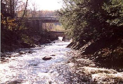
Below the Deep Hole to the river's end, the valley broadens and the Cold River’s swift current carries it over a cobbled river bottom with an average gradient of 40 ft/mile. It crosses under McDermott Covered Bridge in Langdon before entering Vilas Pool, created by a dam at the head of a small gorge. Vilas Pool is a popular place for picnicking, boating, swimming and many summer events in the town of Alstead.

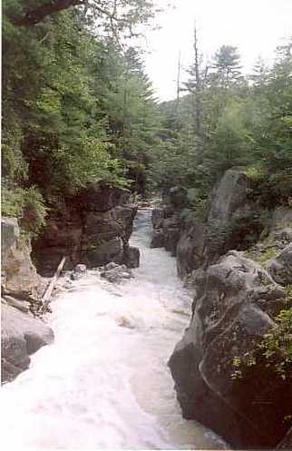
The river flows through Alstead and its valley broadens again. After several miles, the valley walls close sharply and the river drops over the spectacular Drewsville Gorge, where 25 foot cliffs rise above several small waterfalls. Below this gorge, the Cold River cuts through deep sand and gravel deposits that once formed a great delta in the ancient glacial Lake Hitchcock.
As the Cold River joins the Connecticut , it deposits its own sand and gravel in a sand bar that sweeps into the larger and slower Connecticut.
Picture
Powered by Create your own unique website with customizable templates.
  • Home
  • About
    • History of the Committee
    • Annual Reports
    • Bylaws
    • Events Calendar
  • Learn about Cold River
    • Path of the River
    • Wildlife >
      • Habitats
      • Animals >
        • Mammals
        • Fish
        • Birds
        • Invertebrates
        • Endangered Species
      • Plants >
        • Endangered Species
        • Habitats
    • Geology >
      • Bedrock Geology
      • Surficial Geology
      • Sand and Gravel Deposits
      • Prime Agricultural Soils
      • Groundwater Resources
    • Watershed
    • Cold River History >
      • Historical Landmarks
      • Local Oral Histories
  • Water Quality Monitoring
    • What we do
    • Drinking Water Protection Plan
    • Get Involved
  • Conservation
    • Restoration Projects
    • Towns >
      • Town Conservation Commitments
      • Town land use Controls
      • Town Links
  • Educator Resources
    • Activities
    • Artwork
    • River Links
  • Contact Us